
- I was here: one day in April 2013.
- Recommended number of days: one.
- My score: 3/5.
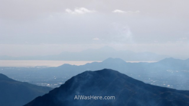
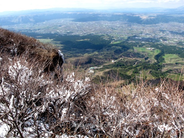
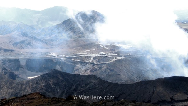
Mount Aso or Asosan is another of the great attractions in Kyushu for the possibility of looking closely at an active volcano. Calmer in recent years than its neighbors in Kirishima National Park and Sakurajima, we will have more possibilities to approach and even walk the edge of its active caldera while we observe its smoky interior. By “active” we refer to its 5 central peaks, especially Nakadake, since the original caldera of this giant covers a diameter of 25 km (15.5 miles) from north to south, 17 km (10.5 miles) from east to west and 128 km (79.5 m) in circumference, the third largest in the world, although it is such a flat area that it would be difficult for us to realize that we are inside a caldera. Luckily, except the active zone, the rest was appeased years ago, and now it is a plain with towns and farms. In its day, the last great eruption 90,000 years ago, was so intense deposited up to 10 cm of ash on distant Hokkaido.

WHAT TO SEE AND DO
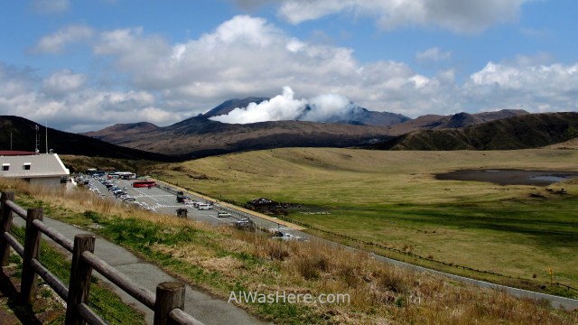
- The biggest attraction in the area are the views of Nakadake crater, which as of April 2019 are restricted because access is not allowed closer than 1 km. The day I went there was restriction due to gas emissions. The cable car was closed and it was not allowed to go up by car nor bus. But all the trails were not closed; You could walk through areas further south of Nakadake, with interesting views of it, though from a greater distance. If it is open, the route around Nakadake and up to Takadake is the most popular and can be done in about 4 or 5 hours.


- Kasusasenri. On the same path up to Mount Aso, on the other side of the road in front of Asosan Museum, extends a meadow where you can walk or practice horseback riding.
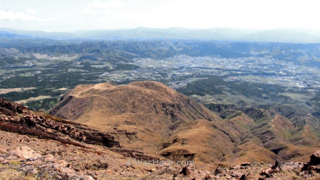
- Daikanbo viewpoint, north of Aso Town, is a favorite with tourists. The panoramic views of the caldera are perhaps the best, although much of the land you see corresponds to farms. To get there you can go by private vehicle, taxi or walking; It is about 7 km north of the town.
- Aso Shrine was partially destroyed by the 2016 earthquake, and is currently in very poor condition.
ESSENTIAL INFORMATION
WHEN TO GO, DANGERS AND ANNOYANCES
Asosan area is basically a volcano surrounded by peaceful cultivated plains, so in terms of weather, despite the rainy Kyushu, the walk can be more pleasant in spring or autumn. What really interests us when coming to Asosan is how active it is:
- Since it emits not only smoke but also other toxic gases; In fact it is forbidden to go up to people with respiratory or cardiac problems, regardless of whether there is a restricted area or not.
- The last relevant eruption was in 2016. Subsequently, it has been appeased, but as of March 2019 access to the summit is restricted; It is not allowed to approach less than 1 km from the Nakadake. This implies that the cable car and public transport will be closed and we will have to climb on foot to where we are authorized. This is not very different from the situation in April 2013, as it happened to me. However, let no one be discouraged, because Nakadake, although it is the most beautiful and active, is not the highest peak, and the walk through the nearby peaks allows great views.
- To know the situation we can check the official website of the Park in this link. We can also ask at the tourist office, adjacent to the train station.
TRANSPORT
Most travelers used to arrive by train. The main station is JR Aso, which is on the JR Hohi line between the cities of Beppu and Kumamoto. I speak in past tense because Kumamoto earthquake in 2016 destroyed some railway lines and as of April 2019 are still not operational in the western zone:
- From Kumamoto we will have to use the bus:
- Bus Kyusanko Odan (1500 ¥, two hours, 2 a day), connect Kumamoto Station, Kotsu Center and the airport to Aso Station. Continue to Beppu.
- Yamabiko Bus (1500 ¥, two hours, 7 a day), connects Kumamoto Station to Aso Station. They stop at Higo-Ōzu Station. Continue to Oita.
- The fact that Yamabiko stops at Higo-Ozu can be interesting, since we do can get there by train using the Japan Rail Pass, and change to a bus, with the consequent saving (Higo-Ozu is approximately halfway, so the rate should be half). If we are going to use this option, we must buy the ticket at Kumamoto Station, or we risk the bus being full when we want to take it at Higo-Ozu.
- From Beppu:
- Yes, we can arrive by train using our Japan Rail Pass (3500 ¥ if we do not have it), it takes 1h45m. If we take a slow train it will cost 2130 ¥ and it takes 3h30m.
- We can also go on the aforementioned Kyusanko bus in the opposite direction. It takes 3h30m and costs ¥ 2980. You can book in this link.
- From Takachiho:
- First you have to take one of the express buses of Nobeoka – Kumamoto line. They leave Takachiho for Takamori at 8:42 am and 4:57 pm, they take 70 minutes. In reverse, they leave Takamori towards Takachiho at 11:17 am and 5:37 pm. They cost 1320 ¥ one way.
- Afterwards, there is usually a scenic train between Takamori and Tateno stations; Tateno station is on the JR Hohi line, where we can take a JR train to Aso station, just two stops eastbound. This train is also suspended due to the 2016 earthquake and its journey is made by a bus that costs the same, but has no scenic views: 460 ¥. For more information, see the post HOW TO GET TO TAKACHIHO.
Another option is a rented vehicle, which also gives us freedom to explore other areas of the caldera. In Aso they are scarce, it is more feasible to rent it in Beppu or Kumamoto. International driving license is mandatory.
Once in Aso, to climb the volcano:
- There are buses every 1-2 hours (650 ¥, 40 minutes) from the train station to the base of the cable car, which pass through the Museum. From 8 a.m. to 5 p.m. At this point, if it is open to visitors, to make the last kilometer and a half we can take:
- A shuttle to the top of the volcano, as there is a road that goes to the edge of Nakadake crater; It costs 1200 ¥ round trip.
- The cable car that costs the same.
- Or walk up, it takes about 20 minutes.
- In case of going by private vehicle, we can get to the base of the cable car. If we want to go up, we have to pay 800 ¥ to use the last stretch of road.
WHERE TO EAT AND SLEEP
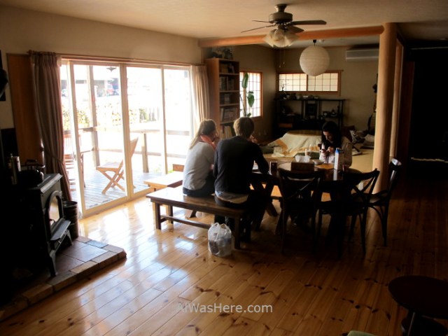
In Aso Town there is plenty of accommodation, but it is bigger than it seems. The best location is close to the station, since it is where we will arrive and from where the buses that take us to the summit leave. There is only one hostel (there was also a very poorly rated Youth Hostel International), which is also exactly there, the magnificent Aso Base Backpackers; spacious, clean and above all cozy, I stayed two nights and I felt at home; 5 years later it still has excellent ratings. There is a campsite 5 km from the station up the road that leads to the top.

Near the station and the Shrine, most restaurants and food stores are concentrated. Typical gastronomy of the area includes akaushi (local organic beef, those grazing freely in the caldera), dangojiru (dumpling soup), takana gohan (rice with mustard leaves) and horse meat, which is usually served raw (basashi).
MORE PLACES OF INTEREST NEAR MOUNT ASO:
<KUMAMOTO TAKACHIHO GORGE>
∇ Destinations / ∇ Asia / ∇ Japan / ∇ Kyushu / ∇ Kumamoto Prefecture

Pingback: EL MONTE ASO (阿蘇山) – Al Was Here
Pingback: Kyushu (九州) – Al Was Here
Pingback: KIRISHIMA NATIONAL PARK – Al Was Here
Pingback: TAKACHIHO GORGE, HOW TO GET THERE – Al Was Here
Pingback: Japan – Al Was Here
Pingback: ESSENTIAL INFORMATION IN KYUSHU: WHEN TO GO, DANGERS AND ANNOYANCES, TRANSPORT – Al Was Here