- I was here: one day in April 2013.
- Recommended number of days: one or a half.
- My score: 2/5.
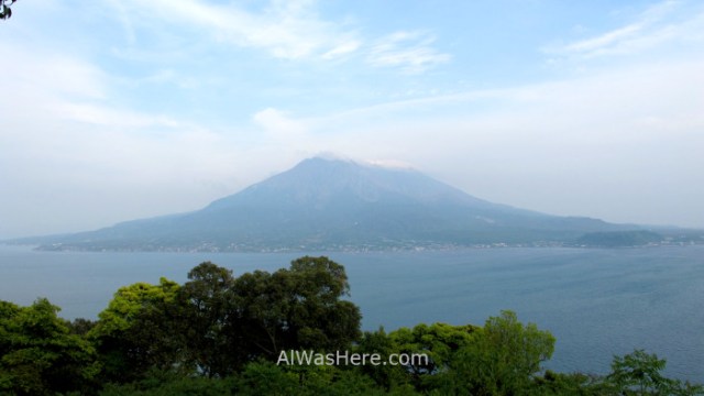
Venerated by the inhabitants of Kagoshima, this ancient island, which since 1914 after an eruption became a peninsula, is the symbol of the city and a place for recreation. Corresponds to a volcanic cone 50 km in circumference, the most active in Japan: it expels smoke constantly since 1955, it can have up to 3 and 4 small eruptions a day and it is not allowed to approach any of its 3 calderas less than 2 km away. It is part of Kirishima Kinkowan National Park, along with Kirishima Massif and Kinkowan Bay.
I agree with them that if it were not for the occasional ash in the environment and the estimated risk of a new big eruption in the next 30 years, I would not mind having a Sakurajima around the corner from my city. It is a pleasant place to walk, with beautiful views of the volcano and the sea, with several private onsens and some free areas, although generally limited to foot bath, and with some interesting gigantic size plants, fruit of the extremely fertile volcanic ash of this place. For the rest, it would be rare for a traveler to arrive here without having gone to Yakushima, and comparisons are odious, but dedicating half day is not wasting time.
WHAT TO SEE
The itinerary starts at the ferry terminal. To the north, about 15 minutes on foot on a hill, is the Dinosaur Park, with 14 life-size statues; excellent for children but with little interest for adults.
But everything else is in the south direction:
- Magma Onsen, an onsen that can be accessed for 390 ¥, open from 10 am to 10 pm. It is part of the Rainbow hotel.

- Then there is Nagisa Park, where there are free hot springs with stone seats to put the feet.

- Nearby is the Visitor Center, with models and information about the volcano. A giant radish model is exposed.

- The following is Nagisa Lava Trail, a 3 km walk along the coast in southerly direction, made on the surface created by the lava in the eruption of 1914. It allows to appreciate the volcanic rocks, as well as interesting views of the sea and the volcano.


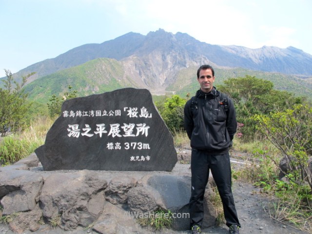
From the Visitor Center, buses leave for the closest viewpoint, Yunohira, which is at the shortest distance that is allowed to go.
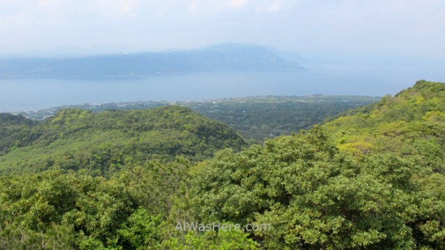
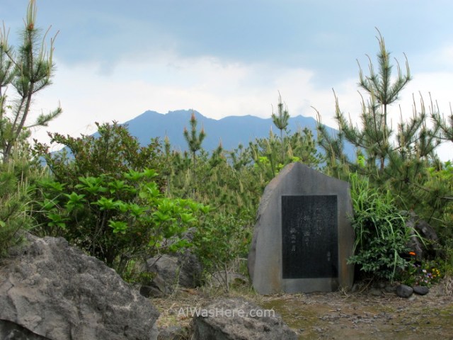
On the road we will see there are roads that go into the vicinity of the peak, but are closed to visitors. This is repeated throughout the peninsula, there is a road that surrounds it close to the coast, with multiple intersections that border the farms of crops, and another that surrounds it in a good part higher, with beautiful views, where we will find accesses towards the top of the volcano every few kilometers, all closed. The other two lookouts are Arimura, to the south, and Kurokami to the east, very close to a torii buried almost entirely since the eruption of 1914.
Thanks to an exceptional volcanic ash, Sakurajima is fertile to a point that scratches the unnatural. The environment is eminently agricultural, especially in the northern part, and although it may seem repetitive, we will hallucinate with the size of some crops, being its specialty giant white radishes, the largest in the world, which usually weigh about 7 kg, but have been registered up to 45 kg.


TRANSPORT
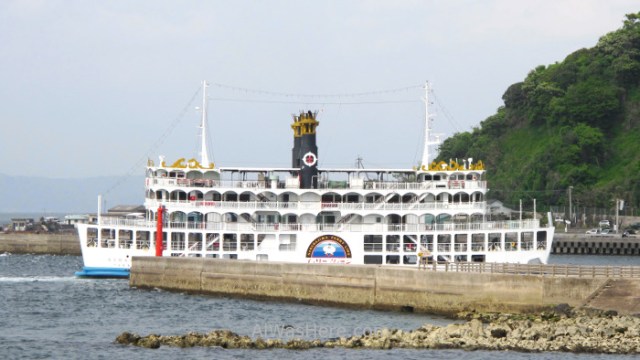
Although it became a peninsula on the east side, Kagoshima City, the most important of its Prefecture, is a short distance to the west. The most usual, easy and fast is to take a ferry from the port; The terminal is less than 10 minutes on foot from JR Kagoshima Station or 5 of the last tram stop, next to the city Aquarium. It works 24 hours a day, every day of the year. The 3.5 km separation distance are covered in 15 minutes and costs 160 ¥. Some boats imitate steam boats.
Sakurajima is too big to walk entirely on foot. The area next to the ferry terminal is where the paths and the Visitor Center are located, but to get a better idea we will need another means of transport:
- Rental vehicle, which can be loaded on the ferry for 1150 ¥. If we do not want to use it, we can go by road, but since the land bridge is to the east, we will have to make a detour of about 65 km. Turning it around completely should take us an hour and we can go to all the viewpoints.
- There is public transport:
- Sakurajima Island View Bus, there is one every hour, go up to the Yunohira viewpoint. The price depends on the distance traveled, but the maximum is 500 ¥ for a day pass.
- There are also bus lines that run along the north and south coast, infrequent.
- Bicycles can be rented at the Visitor Center, they cost ¥ 300 per hour.
There is a pass, the Cute Transit Card. It costs 1200 or 1800 ¥ for one or two days, and covers the ferry routes, Sakurajima and Kagoshima buses and the 50-minute Yorimichi cruise.
WHERE TO EAT AND SLEEP
There are some restaurants near the ferry terminal and there are only two accommodations, Rainbow and the Seaside hotels. I am absolutely sure that I stayed in an accommodation with an onsen, but apparently it does not exist anymore. Neither apartments nor rooms are offered by Airbnb.
ANNOYANCES
Small daily eruptions could leave us covered in ash if one happens when we are too close. It is advisable to wear clothes to cover ourselves, being aware that, although improbable, it may end up full of ash, as well as a hat, glasses and something to cover our faces.
MORE IN KAGOSHIMA PREFECTURE:
<KAGOSHIMA CITY YAKUSHIMA>
∇ Destinations / ∇ Asia / ∇ Japan / ∇ Kyushu / ∇ Kagoshima Prefecture / ∇ Kagoshima

Pingback: SAKURAJIMA – Al Was Here
Pingback: MOUNT ASOSAN (阿蘇山) – Al Was Here
Pingback: KIRISHIMA NATIONAL PARK – Al Was Here
Pingback: Kyushu (九州) – Al Was Here
Pingback: Japan – Al Was Here
Pingback: ESSENTIAL INFORMATION IN KYUSHU: WHEN TO GO, DANGERS AND ANNOYANCES, TRANSPORT – Al Was Here
Pingback: KAGOSHIMA CITY (鹿児島) – Al Was Here
Pingback: Kagoshima Prefecture – Al Was Here