
I was here 3 hours the afternoon of December 27, 2007; and an hour and a half the afternoon of December 31, 2007.
My score: 4/5.
And because of what I wrote about the Drake Pass at Christmas, why not write about another one of those remote places, in fact the most remote, where I have ever spent New Year’s Eve? This island is one of the most famous places and a mandatory stop for all Antarctic cruises.
DATA AND LOCATION
It is one of the South Shetland Islands to the southwest.

Deception, which although it may mean disappointment, it was actually named thinking about the most common sense, which is deceit or delusion, and it is because the island, which is the caldera of an active volcano, seemed a normal island with a rounded shape, but it is not so: there is a small gap just 150 meters wide in the southeast area, called Neptune Bellows, which allows the entry of water and boats into the caldera, forming a great bay called Port Foster that constitutes an extraordinary natural harbor.


Its area is 72 km², similar to the also volcanic island-cone Santorini or Hong Kong Island. It could not be more different from the previous ones, two of the most famous islands in the world, but we must not underestimate the attractions of this subpolar territory:
HISTORICAL
The island was discovered in 1820 by British seal hunters, who soon after settled in its inner bay, free of ice, winds and currents. In just 5 years there was not a seal left in all the South Shetlands, and the island was abandoned.
Until the beginning of the 20th century when, without Greenpeace in between, another new campaign of shearing fauna began; in this case it was the turn of the whales, and Deception Island was again chosen for the possibility of anchoring factory ships safely inside; in summer there were between 10 and 15 whaling ships anchored in the bay. Seeing that the island was fashionable, the British government formally claimed it so that every ship that wanted to stop there had to pay taxes; to show a more convincing image, a customs post, a radio station and a cemetery were built, and a Norwegian whaling company built the first factory on land to take advantage of whale oil and fat, even a small airstrip was built for two-seater propellers. The remains of all these constructions still remain on the island.


Once the whales in the area are almost extinct, the rest of its history is a tug of war for their sovereignty and scientific interests. Several bases were destroyed in volcanic eruptions between 1967 and 1970. Currently, the territory, like the rest of Antarctica, does not belong formally to anyone, and there are two summer scientific bases, Deception Station from Argentina and Gabriel de Castilla from Spain.
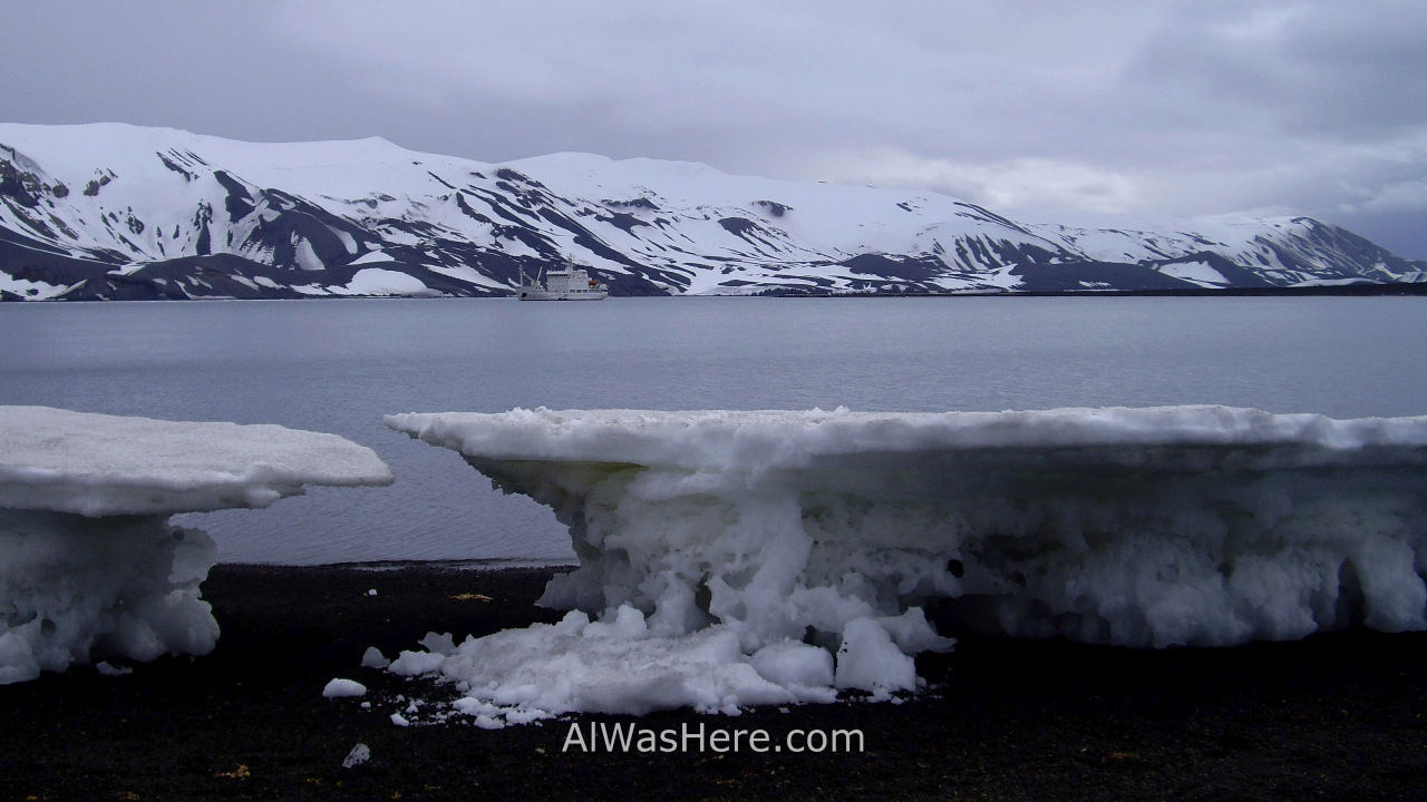
GEOGRAPHY AND LANDSCAPES
The bay at the entrance, called Whalers Bay is the most striking, not only because of the surrounding landscapes, but because of the presence of the ruins of human buildings, but the island is larger than it may seem and has several interesting areas from the panorama point of view. We visited it on the way south, stopping in the aforementioned area, but we also stopped on our way back in Telephone Bay, further north, where the main attraction is the views from Telephone Ridge. Unfortunately we will not be able to climb the highest mountains, in the southern zone, since they are covered by glaciers.


FAUNA
The truth is that we did not see many animals in Deception Island. There is a colony of more than 100,000 chinstrap penguins, and other birds are the subantarctic brown skua, the Antarctic pigeon and some petrels. We also saw some Adelie penguin.


HAVE A SWIM
You have read well: it turns out that this active volcano generates hot springs, many of them are located on the shore of various points of the island, so if you are excited to take a quick dip in the Antarctic Ocean, this is your best option. Eye that I say “take a quick dip”, not “swim”, and it is that even more appropriate would be to call it “splashing on the shore”, because no matter how hot the thermal water comes out, the amount is not so large as to heat the water just beyond two or three meters from where it originates. This explains why if you search Google for photos of tourists bathing in Deception Island, you will find them lying on the shore, close together, and sometimes they even built sand dams so that cold water does not mix with hot water. In our case the thing was not so pleasant, although I admit it was very funny: we were at 0° C (32º F), it was snowing and very windy and the weather was getting worse in a matter of minutes, which already discouraged most of the passage to bathe, and it seems that in the rush the guides forgot to mention the detail that we had to stay right on the shore, or we didn’t understand them well. The point is that when you are at that temperature, while it is snowing and windy and you know that there is hot water on the shore, you take off your clothes and go like lightning there; So while you run you put the first foot in the water and think “that is good, it is hot”, you put the second one ahead and it is not so much, and by the time you intend to stop your run the water is already at 1ºC and you are bathing in the Antarctic at 5 or 6 meters from the hot spring. And yet, I am very bathe in any lake or sea that I go regardless of the temperature, I remember it as a most rewarding experience.


<FULL CRUISE ITINERARY TO ANTARCTICA
PORT LOCKROY>
LEMAIRE CHANNEL>
PLENEAU ISLAND>
PETERMANN ISLAND>

Pingback: ISLA DECEPCIÓN, ANTÁRTIDA – Al Was Here
Pingback: DRAKE PASSAGE OR SEA OF HOCES – Al Was Here
Pingback: Antarctica – Al Was Here
Pingback: HALF MOON ISLAND, ANTARCTICA – Al Was Here
Pingback: CUVERVILLE ISLAND, ANTARCTICA – Al Was Here
Pingback: NEKO HARBOUR AND ERRERA CHANNEL, ANTARCTICA – Al Was Here
Pingback: PARADISE BAY, ANTARCTICA – Al Was Here
Pingback: PORT LOCKROY, ANTARCTICA – Al Was Here