It is one of the most popular trails in Yakushima, for being relatively flat and simple and have a large number of yakusugis in it, and also close, although not on the route, one of the largest and oldest, the Kigensugi. It is accessed from Anbo road, by private vehicle or by bus. You have to change at the entrance of Yakusugi Museum, which has information about these trees and that I personally did not visit (admission 600 ¥, open from 9 am to 5 pm).

Always open, suggested donation 300 ¥. It has 4 routes of different length and difficulty:
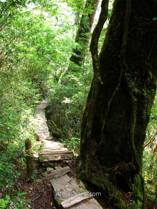
- The 30 (800 meters) and 50 (1.2 km) minutes courses are basically flat and in some sections you walk on boards.
- Those of 80 (2 km) and 150 (3 km) minutes are steeper, in some areas there are stairs.

For me, Yakusugi Land was the icing on the cake. I started my two-day route at the Shiratani Unsuikyo, reached the Jomonsugi and slept in a mountain shelter near the top of Mount Miyanoura. I went down south, but instead of continuing to the coast as most hikers do, I veered east, connecting to Kigensugi road, so I arrived at Yakusugi Land relatively late and tired, and decided to go to rest and return the next day with plenty of time, without an 11 kg backpack on my back.
Following the official map, the route begins at point (1) and ends at (15). The trails are all circular, with the shortest included in the course of the longest.
Before reaching the first famous cedars, we will pass under the trunk of this one.

We will continue through a beautiful and green forest.

A few minutes later we arrived at the first cedar with its own name, the Sennensugi (4), whose name means “a thousand years old cedar”, which agrees with its “young” age.

Those who want to hike the 800-meter route, should turn left at the next intersection. The rest will continue to reach a suspension bridge, the Arakawabashi (5). Before crossing it there is a detour to the left for those who hike the 1.2 km route. If we continue, just 120 meters further on is the detour to the left for the 2 km route. If we have not taken any detour, we will continue along the 3 km route. Take into account that the two longest routes run through steep areas and require a certain physical shape. In this area there are enough cedars, some with their own name, and others that without having it were in my opinion more beautiful; following the route are cedar trees Higchoro (6), Jamonsugi (7) (not to be confused with the famous Jomonsugi) and Tenchusugi (8).

In this area there are fewer tourists, so it is the quietest and most peaceful.

Then there is the Oyakosugi (9), whose name means “mother and son”, one of the most beautiful by having two trunks, each of 2,600 years old and circumferences of 9 and 6.3 meters, although one is dead. Immediately afterwards we found the Mitsunesugi (10), which is another example of a tree that remains on “legs”, after the stump on which it grew has disappeared.


About 500 meters from the above is perhaps the most attractive of the Yakusugis in this area, the Butsudasugi or “Cedar Buddha”, for its large number of knots and folds in the bark and being hollow, 1,800 years old.

The last ones are the Futagosugi (13) and more peculiar, the Kugurisugi (14), which has two very well defined trunks under which the road passes.


If we are more into to see cedars, about 15 – 20 minutes by car or public transport to the west, right next to the road, is the Kigensugi, one of the oldest, 3,000 years old.

MORE HIKING TRAILS IN YAKUSHIMA:
<SHIRATANI UNSUIKYO ARAKAWA TRAIL, JOMONSUGI, MOUNT MIYANOURA, YODOWAGA TRAIL>
∇ Destinos / ∇ Asia / ∇ Japón / ∇ Kyushu / ∇ Kagoshima / ∇ Yakushima

Pingback: YAKUSUGI LAND – Al Was Here
Pingback: TRANSPORT IN YAKUSHIMA – Al Was Here
Pingback: YAKUSHIMA – Al Was Here
Pingback: SHIRATANI UNSUIKYO – Al Was Here
Pingback: YAKUSHIMA: ARAKAWA TRAIL, JOMONSUGI, MOUNT MIYANOURA AND YODOGAWA TRAIL – Al Was Here
Pingback: YAKUSHIMA HIKING TRAILS: YAKUSUGI LAND, SHIRATANI UNSUIKYO AND ARAKAWA TRAIL (JOMONSUGI) – Al Was Here
Pingback: KAGOSHIMA CITY (鹿児島) – Al Was Here