
- Al was here: November 2004
- Number of Days: 3
- My score: 4/5
I’m so glad that I had time to visit this area, because in my opinion, is much more beautiful and interesting than many other sites that are musts in their countries, while it is true that it can not compete with the spectacular beauty of the South Island and is therefore not as well known.
We tourists think the Bay of Islands is everything north of Auckland, when in fact this area is called Northland. Actually, the Bay of Islands is a bay in Paihia area, truly charming, but in my case it was precisely the less outstanding. This area is often forgotten, being the travelers on a rush going as fast as possible from Auckland to the South Island just stopping in Hobbiton.
Keep in mind that being far north, is the area with the best climate in the country (apart from Cook Islands). I went with my dear extinct Magic Bus, but it is an ideal area to drive a rental car or motor home.
ITINERARY
Whangarei
The views from the surrounding mountains are very nice, and most famous are its waterfalls. I’ll just mention the main town because I didn’t go, we were on the west coast rather than east, where kauris are.
The kauri is a type of tree that only grows in the area north of Auckland. This variety does not exist anywhere else, and forms forests of prehistoric aspect with extremely straight and beautiful trees. The main one is Waipuoa, but further north Mangamuka also has excellent examples of this type of trees.

BAY OF ISLANDS
The Bay of Islands is, as its name suggests, a bay in Paihia area, characterized by a steep geography and multiple small islands. It is an area to escape from bustly Auckland, ideal for sailing, hiking or just relaxing. There are many tour operators to perform all these activities.


90 MILE BEACH
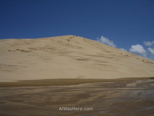
One of the longest straight beaches in the world, although it does not measure 90 but 55 miles (88 km, probably hence the name). It is not a nice beach to swim or sunbathe, as it’s usually windy and wavy. The real joy is drive on it by car, as the beach is so solid and straight that is used as a road.


Besides, at the end there are huge dunes to practice sandboarding.
CAPE REINGA
Along with the forests, my favorite area. The northernmost cape in the country has excellent sandy beaches.

There is also a picturesque lighthouse and a curiosity of nature: at this point opposed currents from Tasman Sea on the west and the Pacific Ocean on the east collide abruptly. This causes, few meters from the coast, a continuous wave that is not directed toward shore, are waves from both sides crashing forever. In addition, Pacific’s water color is darker than Tasman Sea’s, which is very surprising. Anyone who thinks that is because of different depths, can search photos on the internet and check that the line marking the different color of the water is not always in the same place.

MORE ON NORTHLAND:
KAURI FORESTS>
∇ Destinations / ∇ New Zealand / ∇ North Island

Pingback: New Zealand – Al Was Here
Pingback: AUCKLAND – Al Was Here
Pingback: WAIPOUA FOREST AND TANE MAHUTA, THE BIGGEST TREE IN NEW ZEALAND – Al Was Here
Pingback: NORTHLAND: BAY OF ISLANDS y CABO REINGA – Al Was Here