
Portrayed in many films, this beautiful plain dotted with huge rocks is the most recognizable natural place in the country.
HOW TO GET THERE AND VISIT
They wanted to make things simple when drawing the boundaries between states, they just drew a straight line. The park was split in two; most of it is in Utah, but the most famous area is in Arizona.
Yo get there by Highway 163, from Utah in the north or Arizona from the south.

The Visitor Center is in Arizona but keeps permanently Utah time (Arizona and Utah have different DST). Open daily:
- From May 1 to September 30, 6:00 a.m. to 8:00 pm
- October 1 to April 30, 8:00 a.m. to 5:00 pm
Prices: $ 20 per person or per car (maximum 4 people). Since it is a Navajo Tribal Park and not a US national park, National Parks pass is not accepted and therefore it must be paid separately. You can not booked on advance a self guided visit, you have to pay on the spot.

Although there are many companies that offer guided tours, the usual route can be done on your own. The tours, all with Navajo guides, include access to more remote areas, cultural elements and visits to tribes. The only one I would definitely do if I ever return, would be a horseback tour; likely to be expensive, but how much would you pay for a picture of you riding and Monument Valley in the background? These tours you can and should book them on advance.
ITINERARY
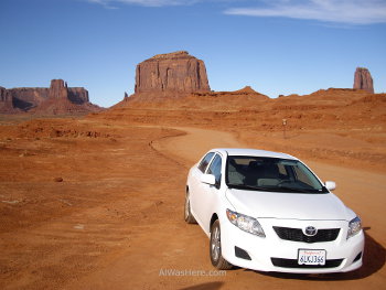
It is a 17 miles circular route on dirt road, but accessible to all types of vehicles. The entire drive is easily visited in a couple of hours. It is not allowed to leave the road without a guide. The points of interest are numbered on the map provided in the Visitor Center.
- The first thing you see is the most famous place: the West Mitten, East Mitten and Merrick Butte. This name is because the natives believed that both seemed the hands of a giant stone.
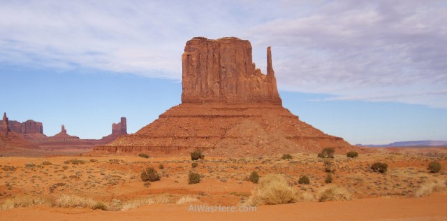
West Mitten - The Elephant Butte, resembles an elephant seen from the front.
- Later, on the right, you can see the Three Sisters, three columns of stone so called because they resemble the silhouette of three nuns.
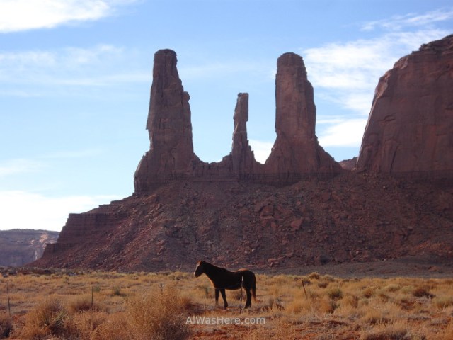
The Three Sisters - John Ford’s Point is a viewpoint dedicated to this filmmaker who popularized the park.
- Camel Butte, where I saw no camel anywhere.
- The Hub is similar to Merrick Butte, but smaller. Here the road turns east passing the Rain God Mesa.

Rain God Mesa is one of the largest rock formations - Totem Pole lookout point, high thin rocks that resemble Indian totems or cactus.
- Sand Springs, another lookout point, closest to Totem Pole, with sandy floor.
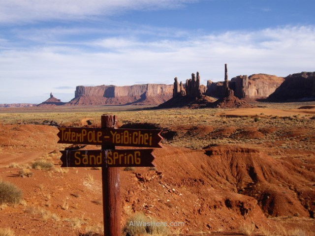
Totem Pole in the background - To the north, the Artist Point, another viewpoint, next to Spear Head Mesa.
- The route continues west, passing through the North Window.
- The last point before joining the point 5 is the Thumb.
The Wildcat trail is three miles long, the only one that can be walked unguided (apart from the main loop if you want to walk it). For other trails you have to hire a guide.
For those interested, you can camp in a basic way asking permission.

Spectacular images. Thank you for sharing them.
LikeLike
Pingback: ANTELOPE CANYON – Al Was Here
Pingback: Arizona – Al Was Here
Pingback: EXPLORING ARIZONA FROM LAS VEGAS – Al Was Here
Pingback: MONUMENT VALLEY – Al Was Here
Pingback: United States – Al Was Here