The following itinerary is intended to be done by car, as I describe the main viewpoints that are reachable from the road. For those with little time, the view from the different viewpoints does not vary substantially. No need to stop at each one, even less in the ones that are nearby. From the further west point to the last in the east there are approximately 45 km.
HERMIT’S ROAD
We start the route in the most westerly point, Hermit’s Rest, named after prospector Louis Boucher, responsible for the construction of the Rim Trail; he settled and lived alone in this area for years. The building was built in 1914 as a rest area for tourists on their way to the missing Hermit Camp. It is the starting point of the Hermit Trail, which corresponds to the end of the Rim Trail. In high season, to explore this area is mandatory to use the minibus.
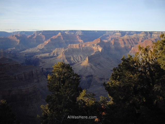
The following viewpoint, probably my favorite, is the Pima Point.
On the road we saw frequently elks, a type of huge deer.

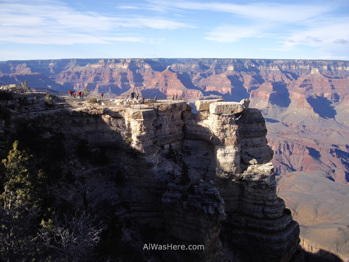
GRAND CANYON VILLAGE
The views from the Rim Trail near the village are the best.

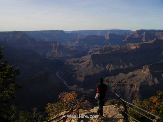
My favorite viewpoint in this area is Mather Point, since you can admire the canyon and Yavapai Point on the left.

The visitor center, besides having good views is likewise very interesting. There are models, maps and all the information necessary to explore the park.
Continuing eastward you’ll reach the road leading to Yaki Point, but more important, the South Kaibab trail starts here, the trail that crosses the canyon to the north side. This trail we did walk it partially. If you are attempting to cross the canyon, it is recommended to go down there to Phantom Ranch (11 km), spend the night and continue the next day to the northern edge (another 21 km). From the trailhead on the north side there are still 3.5 km more to the accommodation areas, from where you can take a minibus to return. But there are intrepid travelers who after that beating they do not have enough, so they keep walking back to the south rim. People who do this are superclasses, those Ironman finishers, they are very prepared and psyched. And then there’s my cousin Javi, who began walking from the south side saying ‘I’ll walk until I get tired and then I’ll go back, let’s see how far I get’ and did so in less than 24 hours, with little equipment, almost no food and just a one liter water bottle that had to be filled every now and then, but as he says, if it had gone down fully equipped instead of carrying a tiny backpack, maybe it would not have succeeded. From here I encourage and invite him to write on my blog or in his own one this madness that ended up being a feat.

DESERT VIEW ROAD
The scenic road continues for 35 km parallel to the canyon, with lots of viewpoints, but do not add much to the previous landscapes. The only different is precisely at the end of the road, because the river meanders northward instead of eastward, adding another point of view.

At the end of the road is the Desert View Tower, old style of Native Americans decorated in the inside.
MORE ON GRAND CANYON NP:
ESSENTIAL INFORMATION>
∇ Destinations / ∇ United States / ∇ Arizona / ∇ Grand Canyon

Pingback: GRAND CANYON – Al Was Here
Pingback: GRAND CANYON, useful information – Al Was Here
Pingback: Arizona – Al Was Here
Pingback: ITINERARIO: BORDE SUR DEL GRAN CAÑÓN – Al Was Here