
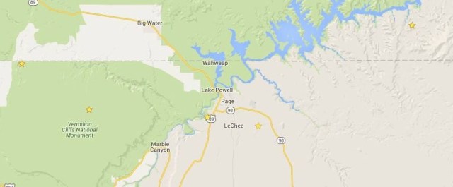
Page is a 7,000 people town in northern Arizona. By itself is not interesting, but the surrounding nature is spectacular, so it has become the main base for exploring the north of this state. Some of the most important natural monuments in the country are close enough for a day trip. Several are world famous, but most of the people don’t not know they’re here.

Accomodation is Page is expensive and scarce even in low season. Unfortunately is almost the option nearby.
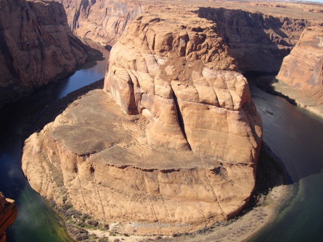
The closest, just 10 minutes by car (8 km) south on 89, plus 5 minutes walk, is the well-known HORSESHOE BEND, a meander of the Colorado River.
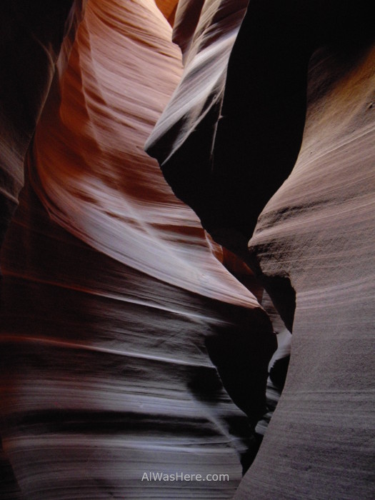
Southeast by 98, within a 30 minute drive (15 km approximately, the last sandy track) is the ANTELOPE CANYON (see specific post). From the Navajo reserve, which also can be visited, it is mandatory use an official vehicle and go with a guide, so normally transport is taken directly from Page. This narrow canyon is famous for its poetic forms along with the play of lights and shadows the sun makes in it.
And now more distant and less known sites. That happened to me, I did not know about them and left without seeing them, so no photos, unforgivable.
Immediately north of Page is Lake Powell, artificially formed after the construction of Glen Canyon Dam, forming the GLEN CANYON NATIONAL RECREATION AREA. This area, which runs almost entirely in Utah, is excellent for hiking and especially to go around the lake by boat. The most famous natural monument is the Rainbow Bridge National Monument, one of the natural largest stone bridges in the world, not the largest as often proclaimed, as there are longer archs in Utah itself and taller, wider and longer bridges in Chad and China. Still worth the two-hour ride by boat from Page.
And the farthest away, about an hour and 10 minutes (45 miles), just 500 meters after re-entering Arizona from Utah, in the area known as VERMILION CLIFFS WILDERNESS – PARIA CANYON, particularly in North Coyote Buttes, is the WAVE ROCK, a spectacular sandstone formation that resembles petrified sand dunes. In addition, just 300 meters away there are other interesting secondary formations, such as the Second Wave, the Melody Arch or the Big Mac, so named because it resembles a 2 meters high hamburger .
The bad thing, only 20 permits per day, 10 reservations online, plus 10 that are drawn the day before (you must be there) among those who did not get a reservation, and although there is a dirt track that is very close, the lucky ones who have a permit still will have to walk at least 13 km in the desert, between rocks and dunes. To get permission you should go to the official website, where the complex process is explained, four months in advance.
If you want to continue, after an hour and a half, you can explore in depth the VERMILION CLIFFS NATIONAL MONUMENT, with areas where erosion reveals different red tones on the side of the mountain, though personally, I wouldn’t say whether is worthy the effort to go up there. It reminds me of Almeria Tabernas desert, just a little more colorful.
You bet I’m going back to Arizona.
∇ Destinations / ∇ United States / ∇ Arizona

Pingback: ALREDEDORES DE PAGE – Al Was Here
Pingback: Arizona – Al Was Here
Pingback: ANTELOPE CANYON – Al Was Here
Pingback: EXPLORING ARIZONA FROM LAS VEGAS – Al Was Here
Pingback: United States – Al Was Here