
Updated July 6, 2019
In Bali there are several, but mainly these two volcanoes are the interesting ones, being the largest and the only active ones. Most tourists are happy with a photo of them, but if someone is thinking about a closer approach, here’s how to do it.
GUNUNG AGUNG
INFORMATION
ACCESS TO ITS TOP IS PROHIBITED SINCE THE END OF NOVEMBER 2017 BY BEING IN ERUPTION, which forced to evacuate more than 100,000 people in a radius of 10 km. Since then the volcanic activity fluctuates, but there is still danger of eruptions every so often. The last one of considerable intensity was registered on May 25, 2019.
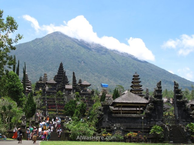
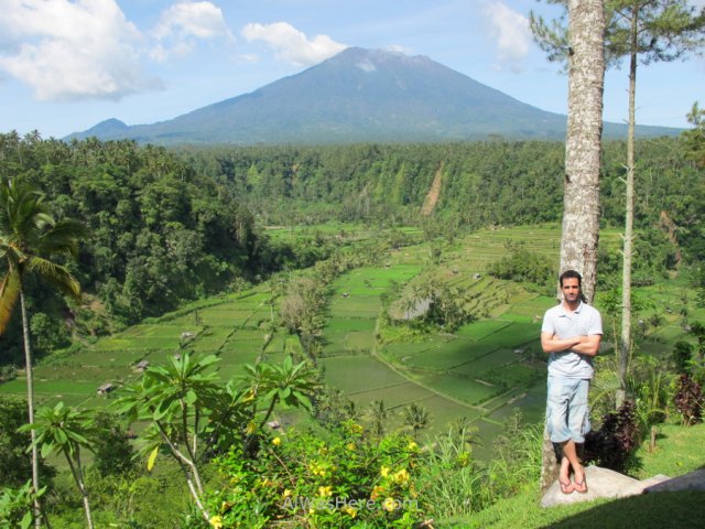
It is the highest point of the island, 3031 m of altitude. Although previously the last eruption dated back to 1963, up to 2017 columns of smoke and ash ejection could be observed frequently. Because of its shape, Balinese consider it a divine replica of Mount Meru, center of the universe where Hindu deities live, so Pura Besakih, Bali’s main temple, was built in its southwest base. In this last eruption, lava just passed meters nearby the temple without touching, which increased its fame as a religious place.
GOING UP
After the eruption in november 2017, probably it will take years to allow again the hike. I did not go up, but it could be done by two routes:
- From Pura Besakih, which is 1100 m above sea level, a trail leads to the highest peak, the western. It is the hardest route, it takes more than 6 hours just the way up.
- From Pura Pasar Agung, another temple located east of the main one, although the road to get from one to another makes a detour of 22 km. Leads to the south peak, 4 hours one way.
This is not an easy trek, it is essential to be well equipped and physically prepared before you go. It is recommended to avoid climbing in the rainy season (especially January and February). Once left behind the temples, the walk goes through jungle before the arid lava fields. Once on one of the summits there’s no path to the other. Because of the tropical weather, the climb usually starts at night, trying to reach the summit at dawn.
You can go it alone or hire a guide in any of the two temples, but apart from the mafia-mannered guides that harass anyone who tries to go alone, you must be aware that at the top it can get cold, windy or rainy, and the path is not well marked. Save time and trouble hiring a guide; prices usually start 700,000 Rp per guide, but will depend on your ability to haggle. The truth is that even now the summit is officially closed, when the volcanic activity decreases, there are many tourists and guides who skip the prohibition and climb it to the top. Normally, those who want to climb, should go to the beginning of the trails, where they will find guides willing to accompany them for the usual rates.
HOW TO GET THERE
The bulk of tourists hires a pack in their hotels or agencies; they include guide, transfer from the hotel, food and water from Rp 900,000 per person; most only ascend the Pasar Agung trail. Those who come on their own, it is easiest to rent a vehicle; by bemo you can reach Besakih from Klungkung, but not Pasar Agung.
The official tours that are currently offered consist of panoramic views of the volcano from different points of the island, no agency will promote that they offer to climb to the top, even if they do.
GUNUNG BATUR
INFORMATION
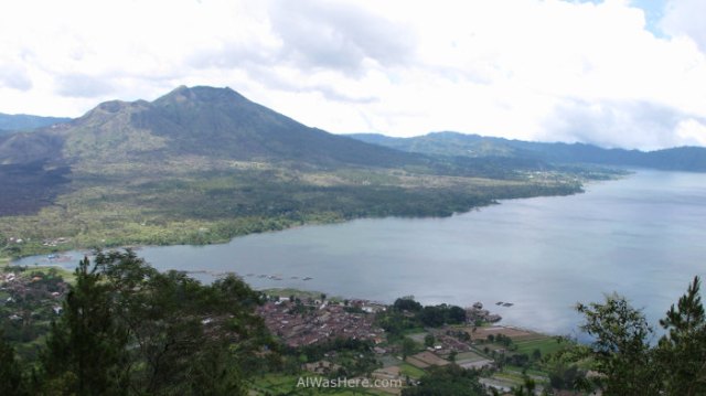
Only 1717 m high, it was considered the most active volcano in Bali, although the last erupting one has been Agung, and one of the most active in Indonesia; its last eruption was in 2000. It has a wider main caldera, whose eastern third is occupied by Lake Batur, while a second cone grows in central-western area, creating a beautiful image.
GOING UP
To go up is required to hire a guide from Mount Batur Guides Association, from 250,000 Rp per person approximately, although if there are two or more climbers you can expect to pay about 400,000, which is still very expensive, especially considering this hike is much simpler than the previous volcano; it takes about two hours to reach the summit. There are two paths, with the one starting at Toya Bungkah being the most recommended because the first part is covered by jungle; both of them leave from the lake. The climb also starts at night to reach the summit at dawn. It is recommended to avoid climbing in the rainy season (especially January and February).
HOW TO GET THERE
You can also arrange excursions like the ones for Mount Agung from Rp 650,000 per person (cheaper the more people there are in our group). If you decide to go by yourself, there are few buses from Ubud and bemos and buses from Denpasar airport arriving in Kintamani, about 7 kilometers west from the start of the trails.
MORE THINGS TO DO IN BALI:
<BEST RICE FIELDS
BOTANICAL GARDEN AND BALI TREE TOP ADVENTURE PARK>
∇ Destinations / ∇ Asia / ∇ Southeast Asia / ∇ Indonesia / ∇ Bali

Great advice interesting post thanks 👍
LikeLike
Pingback: Bali – Al Was Here
Pingback: BEST TEMPLES IN BALI – Al Was Here
Pingback: TEGALLALANG, JATILUWIH AND OTHER RICE TERRACES IN BALI – Al Was Here
Pingback: PROBLEMS AND ANNOYANCES IN BALI – Al Was Here
Pingback: VER O SUBIR A LOS VOLCANES DE BALI: BATUR Y AGUNG – Al Was Here
Pingback: BOTANIC GARDEN AND BALI TREE TOP ADVENTURE PARK – Al Was Here